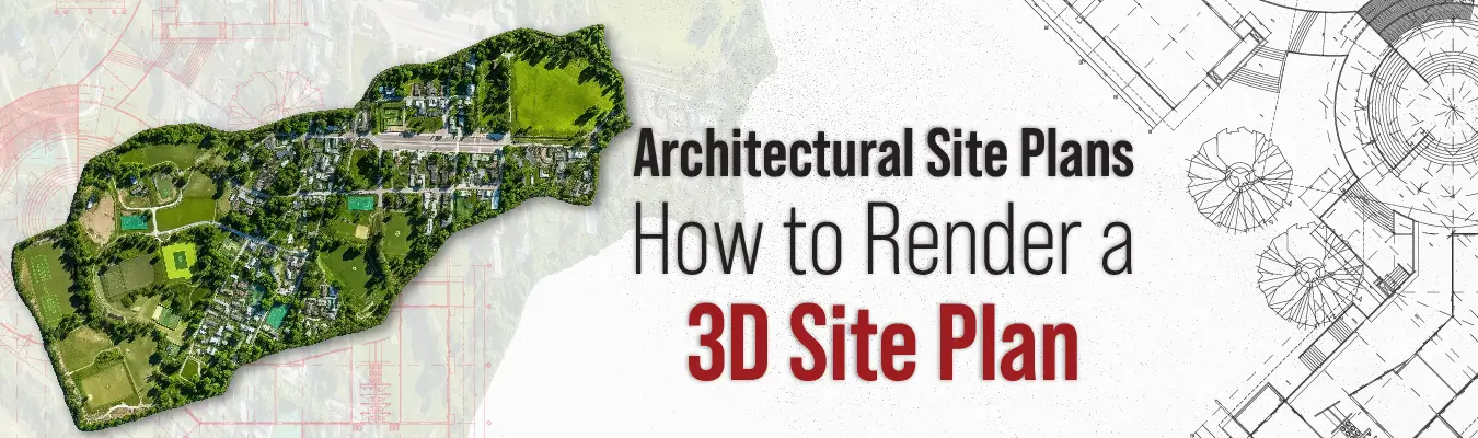
What Are Site Plans and How to Render a 3D Site Plan?
In architecture, to put it simply, a site map (or a site plan) is a diagram that shows the overview or layout of the property. What a site map does is visually represent information about a property, like buildings, roads and sidewalks, structures, trees and landscape, parking lots, utilities, and so on. It also depicts proposed conditions and changes in the area, like upcoming parks, buildings, roads, etc.
So, why are site plans made?
The purpose of a site plan is to give an overview of the entire site or property, usually when it is to be modified (residential or commercial). You’ll see these site maps used mostly by urban planners, engineers, architects, construction companies, contractors, and landscapers.
Broadly speaking, the purpose of a site plan is to
- Show how the use of the property will relate to the surrounding areas.
- Show proposed structures.
- Help building officials check zoning and building codes.
Site maps are valuable sources of information about the area for purposes like:
- Building construction
- Renovations
- Home improvements
- Redevelopments
- Urban planning, etc.
Say you want to construct a building complex at a particular site. You’ll need a site map to understand the layout of the area, existing structures, surrounding areas, etc. Having information about the site layout in the form of a site map makes you better prepared for construction.
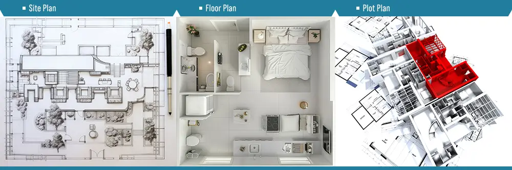
Site plans, floor plans, and plot plans: what’s the difference?
-
Site plan vs floor plan
Site plans are an aerial view (or overhead view) of a piece of land. Conversely, floor plans are an overhead view of the layout of a floor. It's essentially an interior map of a building's floor. If the building has multiple floors, there will be numerous different floor maps for each floor to show the layout.
To make a site map, you typically start by drawing the property lines and exact measurements between the various components that exist in the property. So, essentially, all the focus is on what's outside the building.
Floor maps are the opposite, as they are scaled drawings or diagrams of the interior of a building. They contain the room sizes, windows, doors, entrances, exits, fixtures, and how all of them relate to each other. They’re quite crucial for interior design.
-
Site plan vs plot plan
The terms "site plan" and "plot plan" are many times, used to refer to the same thing. But, they are different, although the differences are very few. A plot plan is a map or diagram of a plot of land or a property. They usually contain the property, any structures, boundaries, and some key outdoor features.
Site maps have a much bigger scope. They contain the layout of the property or plot, as well as the surroundings. For example, a site plan will include surrounding elements like streets, landscapes, rivers, etc. Sometimes, parts of neighboring plots are also included if they are relevant to your project.
Types of site plans
-
2D site plan
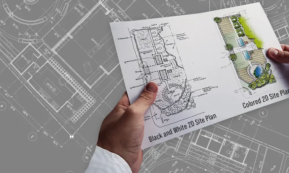
A 2D site plan is a regular bird's-eye view sketch of the property. As you can see below in the image, it's a flat layout of the property and the surroundings, showing the location of the existing and proposed structures and elements. As you can see, they can be in black and white and in full color.
It is a basic illustration that can be either drawn by hand or using a software. Some of the most popular software used to make 2D site maps is AutoCAD 2D and RoomSketcher App.
When compared to a 3D site plan, 2D plans are more technical as they include measurements and labels. They’re basically 2D blueprints, hence they’re perfect for illustrating important elements of a property.
-
3D site plan
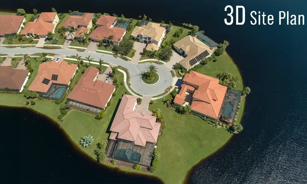
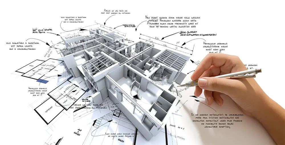
Think of 3D site plans like a pop-up book version of 2D plans. Just like regular site maps, 3D plans give you an aerial view of the property and any existing or proposed structures. However, apart from being like pop-ups, they also show the interiors of a structure, like the furnishings, surface coverings, traffic flow, landscaping, etc. (as seen below).
While 2D plans are mostly technical, 3D site maps are more visual and show textures, colors, and details. They are mainly made to make it easy to visualize for clients who don't know how to read technical 2D site maps.
Now, making 3D maps isn’t as simple as making 2D plans. You need a 3D modeler, 3D modeling software, and someone who can render the 3D maps. Let’s take a more detailed look at how 3D site plans are rendered.
3D site plan rendering: how it’s done
Before rendering a 3D site map, the 3D artist needs to get all the information about the property and understand the layout. All these details (like 2D blueprints, building plans, and measurements) are necessary for visualization. The camera angles for 3D rendering are set based on this data.
Once the 3D artist has all the information they need, they use 3D modeling software to create a digital model of the site or property. At this point, it is incredibly vital that the base model be as accurate as possible.
Once the base model is ready, the next step is 3D texturing, where textures, colors, and 3D images are added to the model to make it look appealing and life-like. Not all clients may want photorealistic 3D renders of site plans. Sometimes the bare minimum is enough when the maps are only for architectural planning.
However, to make brochures for marketing and promotion of the construction project, clients will often require photorealistic renders so buyers can get an accurate visualization of the proposed building/structure.After 3D texturing, your site model is ready for the lighting stage- an important part of the rendering process. If you guessed that this lighting is similar to the lighting in photography, then you are correct. Lighting adds a bit of realism to digital models. In the rendering software, the 3D artist will digitally recreate the lighting conditions as per the client’s needs. It could be sunlight, moonlight, or artificial lighting (streetlights, indoor lights, outdoor lights).
After the 3D artist finishes setting up the lighting conditions, the scene is ready to be rendered. Rendering is very similar to taking a photograph. It’s basically a 3D photo. Camera angles are set within the software, and the scene is rendered.
Depending on the complexity of the 3D scene, rendering generally takes anywhere from a few hours to a few days. But in the case of 3D site plan renderings, it usually takes about a day.A 3D artist’s job is not over after rendering. The renders are sent to the client for approval in a lower-quality format. It will be reviewed, and the client will make a list of changes they want (if any) in the render. The 3D artist then makes the changes till the client is satisfied and then begins the final rendering process.
The final 3D site map renders are then submitted to the client in different file sizes and resolutions. These are usually predetermined before the 3D artist starts the project.
Key elements of a site plan
There are a few key elements all site plans need to have. They’re as follows:
- Your basic information (name and address)
- Legal description of the property (city, county, range, township, ZIP code, section)
- Property boundaries (lines marked around the perimeter of the site that show the property limits)
- Setbacks (distance between the building and property lines)
- Existing and proposed conditions (like fences, utilities, and power lines)
- Construction limits (shows where the construction is taking place and where construction materials and equipment will be stored on the property)
- Driveways, pathways, and parking areas
- Neighboring streets and street signs (show how traffic flows through and around the property)
- Fire hydrants (according to city codes)
- Easements (features of the property that are shared with others, like pathways)
- Landscaped areas (important for maintaining the ecosystem)
So, should you get a rendered 3D site plan?
If you want to use the site plan in brochures and marketing materials, then the answer is “yes”. In these cases, you want really good-looking visuals that will attract attention and make it easy for potential buyers to understand the final look. So, photorealistic renders will be your best bet here.
Even if you aren’t going to use the plans for marketing, you can still get some benefits from 3D-rendered plans. You just don’t need to get hyper-realistic-looking ones. As 2D plans can be too technical or even confusing, sometimes 3D renders make understanding the designs easier.
So, ultimately, the choice is yours.
Contact Us